The area now known as San Francisco is the unceded Ancestral homeland of the Ramaytush Ohlone peoples of the San Francisco Peninsula. As the original peoples of this land, the Ramaytush Ohlone have never ceded, lost, nor forgotten their responsibilities as the caretakers of this place.
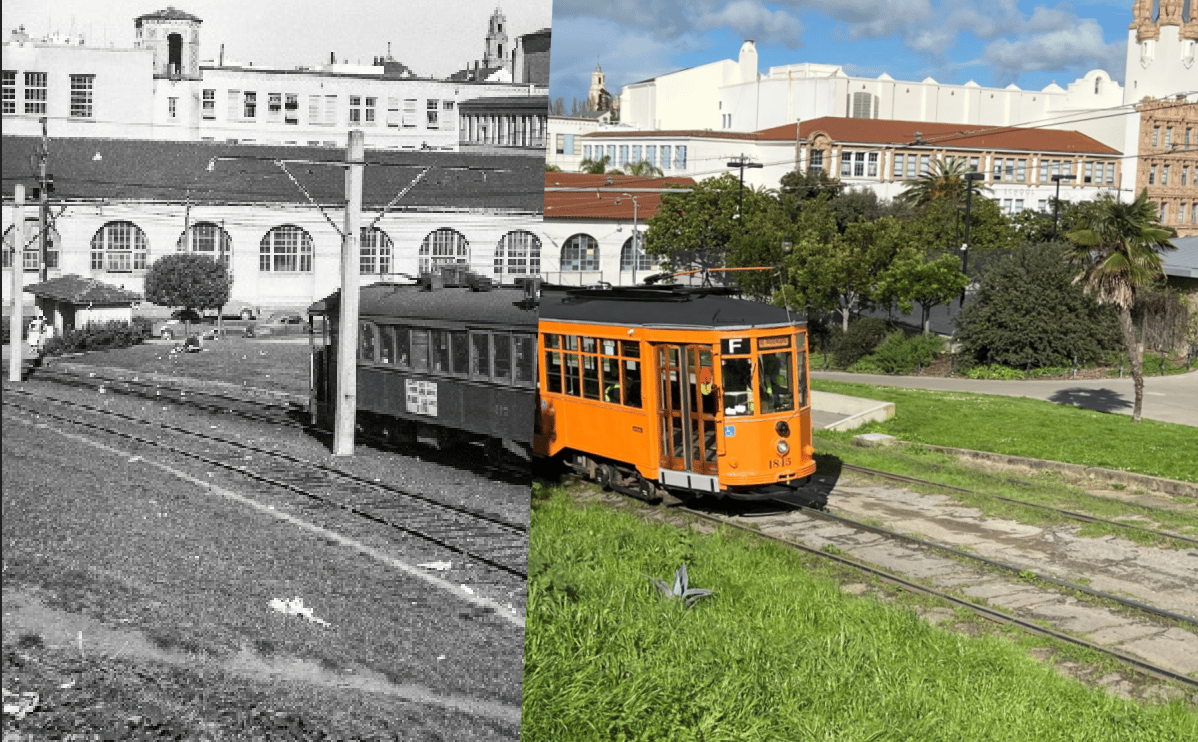
Recently I came across some wonderful old photographs taken of the same 27-acre plot of land in the Mission District, known today as Dolores Park. As my neighborhood park I thought it would interesting to recreate some of these photos so we can compare the Dolores of 2024 to the Dolores of the past 150-odd years.
In some of the older photos, the landscape has since changed so much that it was difficult to find the same vantage point in today’s park, in other circumstance tree growth or new structures had sprung up to obscure the view, but I did my best, and it was an interesting little project. Let’s take trip down memory lane…
Dolores Park as a Jewish Cemetery
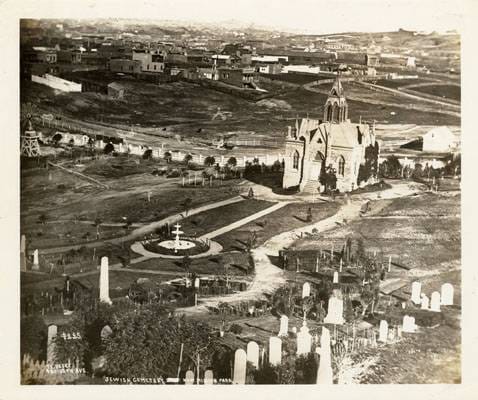
Mission Park (later called Dolores Park) as a Jewish Cemetery in 1876. Opened in 1860, closed in 1888, most remains moved from 1890–1895. Image via FoundSF
Dolores Park 2024
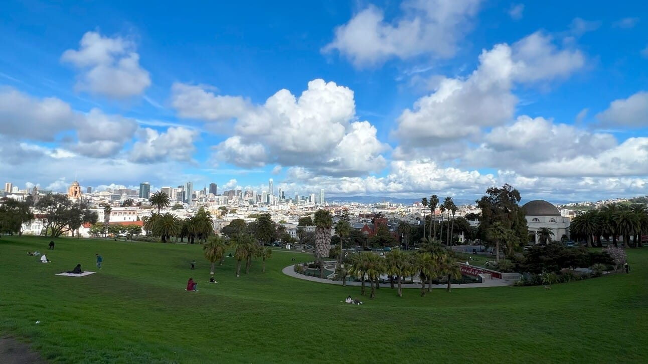
From 1860 to 1888, Dolores Park was a big cemetery for Jewish folks. In the 1890s the City decided that all cemeteries should be removed from San Francisco to make room for the growing (living) population. Many of the bodies were moved down to Colma, and still rest there today.
In fact, the only cemeteries left in San Francisco today are at the Mission Dolores de Asis, and in the Presidio. By 1902, it became illegal to bury new bodies in the city. You can read more about where the bodies are buried here.
DOLORES PARK CIRCA 1880
A view of Mission Park (later Dolores Park) as a Jewish cemetery, about 1880. Potrero Hill is in background right, 18th & Dolores at middle left side. Image via FoundSF
Similar vantage point 2024
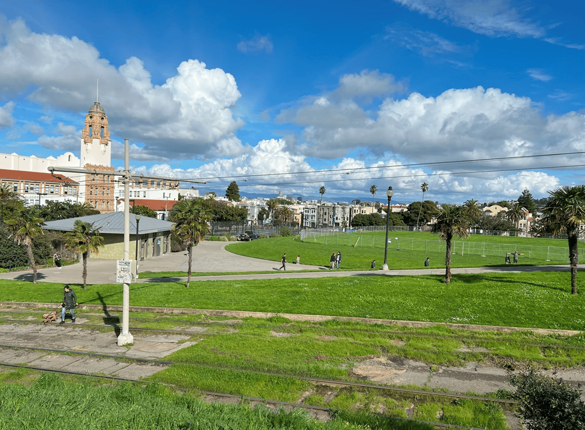
Dolores the Refugee Camp 1906
When half the city burned down following the 1906 earthquake some 500 temporary cottages were built on Dolores to house the refugees, There were 10 other refugee camps built in other parks around the city.
Image: OpenSFHistory
Dolores Park, During the 1906 Earthquake and Fire, Looking northeast from Church and Cumberland Streets. Dolores Park full of refugees and wagons with the city burning down in the background.
Church St. & 20th, 1914
Image: OpenSFHistory
Church St. & 20th, 2024
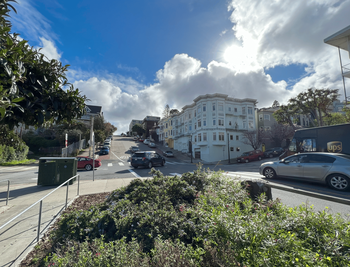
The Original construction of the J Church Line 1916
Church near 20th,1916 – J Church, a man laying track. Youth’s Directory on left; Mission high school on the right.Image via opensfhistory.org
J Church 2024
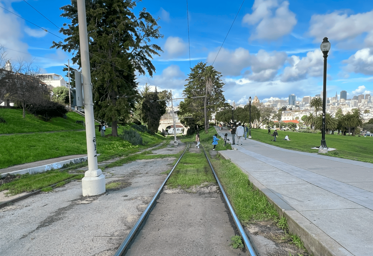
From the same vantage point, the track somehow looks a bit rougher today.
J Church 1948
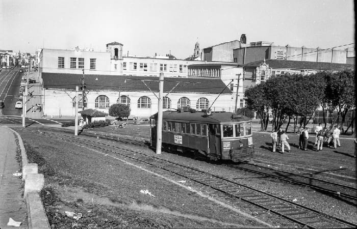
Dolores Park,1948 – Mission High School at Church/18th J Church streetcar. Image via opensfhistory.org
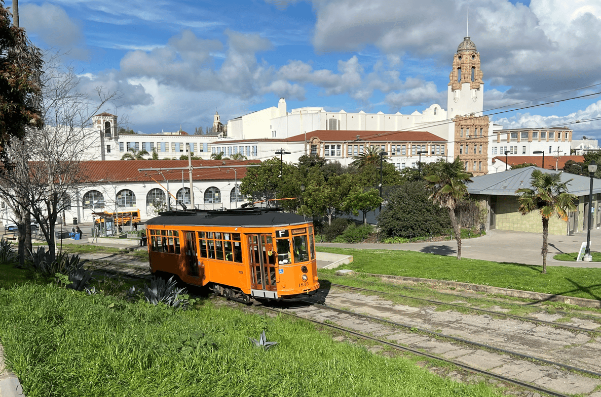
It was a bit of luck to see one of San Francisco’s Historic Streetcars come up the tracks in 2024, it’s wonderful to see the preservation of these classic street cars, and have a historical reenactment on the tracks now and again!
Mission High School,1923
Image: OpenSFHistory
The new tennis courts (renovated in 2015), made it so I couldn’t get the same vantage points on the grassy knoll as the historic photos of Mission High School.
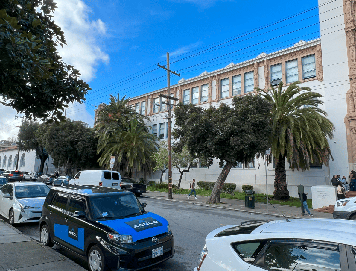
Mission High School 1935
Image: OpenSFHistory
Mission high school 2024
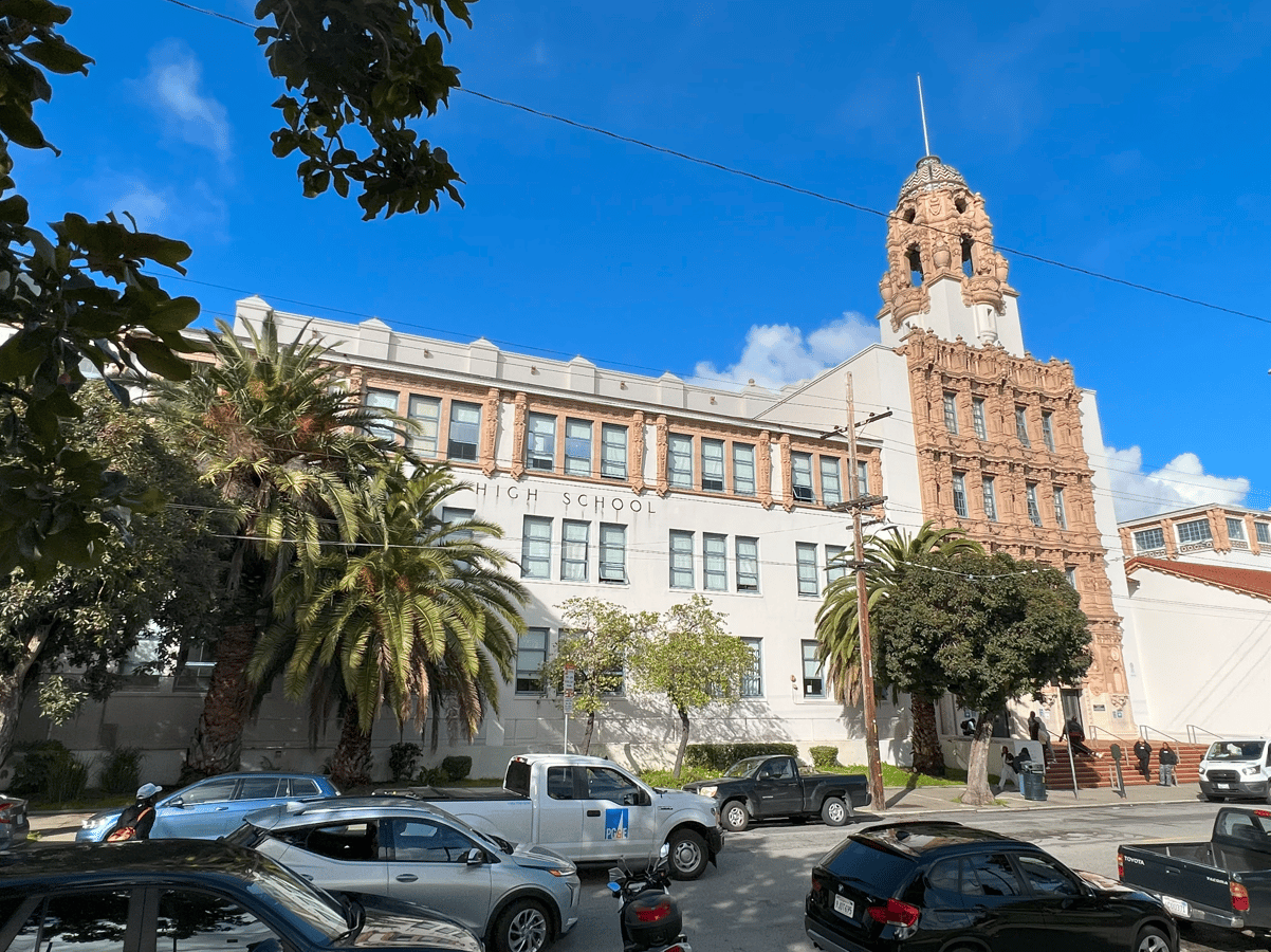
Dolores Park,1917 – Mission Park, J-Church Line dedication
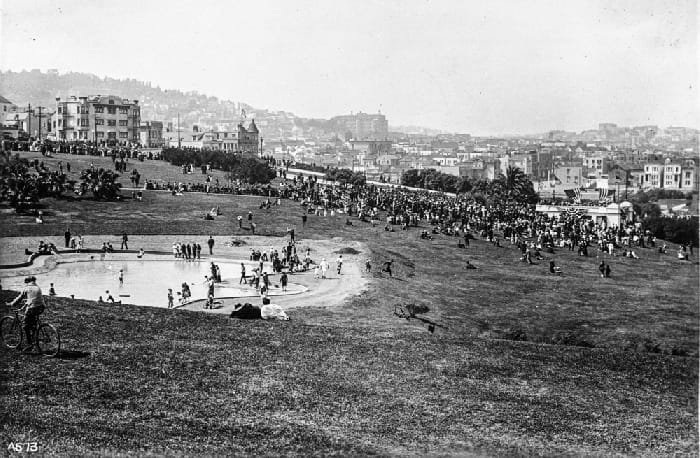
Did you know that where the fancy playground is today, there used to be a large wading pool? I suppose for fine dandies to roll up their knickers and get their feet wet. In the 1920’s the fun police got rid of it and built the first rendition of a playground. This area of the park has been lousy with children ever since. (It was also during this period that the tennis and basketball courts were first built.)
Helen Diller Playground 2024
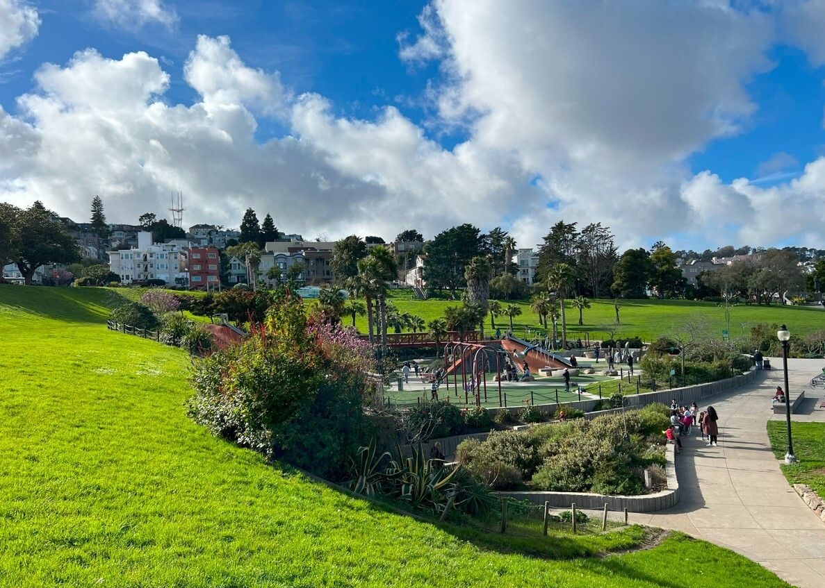
In April 2009 the new Helen Diller Playground began construction on the spot of the old playground.
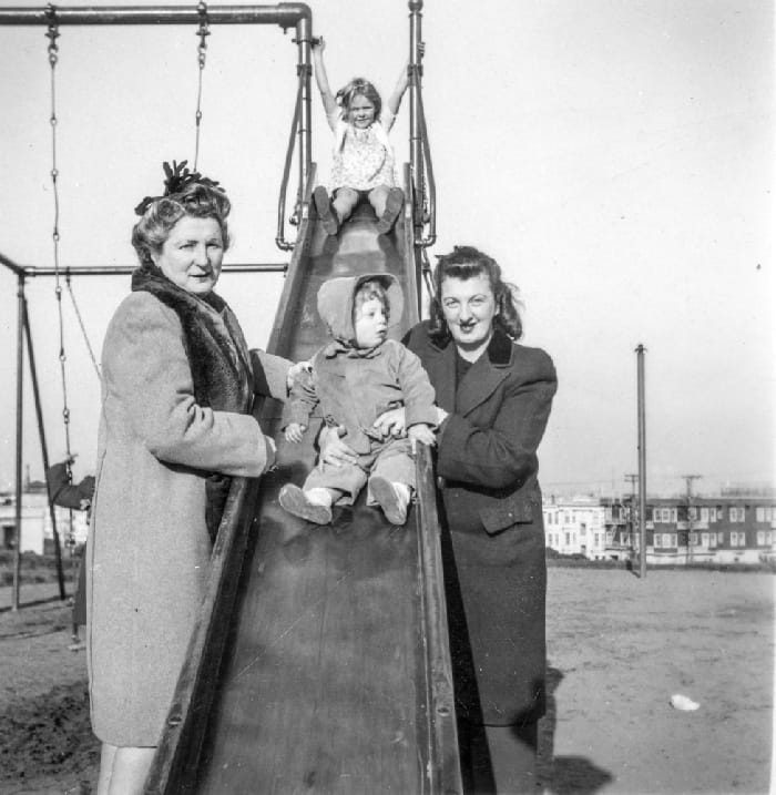
1945
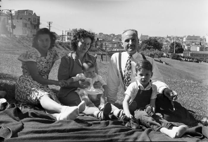
Gay Beach was a bit different in the 1940s
A slide in 1945
The big slide in 2024
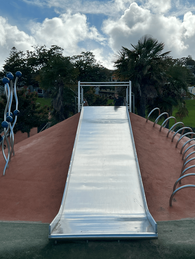
The color photos were taken by @alexmaksf, the historic photographs came from openhistory.org and FoundSF.org, these two wonderful archivists are non-profits, so go check them out, and consider donating to them so that we can keep our history alive online and open to the public!
The post A Photographic History of Dolores Park, Then and Now appeared first on Broke-Ass Stuart's Website.


